搜索结果: 31-45 共查到“知识库 激光及激光器技术”相关记录3533条 . 查询时间(5.484 秒)

【Review】大口径强激光光学元件超精密制造技术研究进展(图)
惯性约束聚变 高功率固体激光 非球面磁流变加工 气囊高效抛光
2021/12/30
本文以实现移动小型智能化系统的实时自主定位为目标,针对激光里程计误差累计大,旋转估计不稳定,以及观测信息利用不充分等问题,提出一种LiDAR/IMU紧耦合的实时定位方法—Inertial-LOAM.数据预处理部分,对IMU数据预积分,降低优化变量维度,并为点云畸变校正提供参考.提出一种基于角度图像的快速点云分割方法,筛选结构性显著的点作为特征点,降低点云规模,保证激光里程计的效率。
再制造技术是一项节能、绿色、环保的修复改造技术,作为制造产业链的延伸以及先进制造、绿色制造的重要组成技术,自进入人们的视野以来,在制备工艺和加工参数优化,尤其是在缺损零件的反求建模、成型评价、三维开发以及自动化等方面,短短几年内取得了众多的研究成果。增材制造技术中,激光熔覆成型技术将表面强化技术和激光快速原型制造技术相结合,因成型后的零件具有组织性能优良、柔性化程度高、应用材料种类广泛以及可制备复...

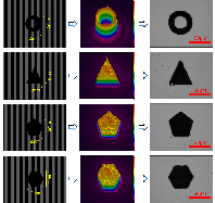
超快激光具有超短的脉宽,能够在极短的时间尺度内与材料作用,而不产生烧蚀,属于“冷加工”,有着热影响区域小,精度高等优点。然而,在一些行业的应用,如消费电子行业,计算机行业,通讯行业,芯片行业,加工时激光器输出单脉冲能量远远高于所需的能量,若是用单光束加工方式,激光器输出能量大部分被浪费,加工效率低,用多光束并行加工可以有效解决上述问题。
基于三维点云的同时定位与建图(Simultaneous Localization and Mapping, SLAM)是机器人导航与定位领域重要的技术之一. 然而具有回环检测功能的这类SLAM系统仍鲜见于文献中. 本文首先提出了一种新的基于三维点云的室外SLAM 系统的框架, 该框架由里程计, 回环检测, 位姿优化三部分组成. 其次针对回环检测,我们提出一种基于点云片段匹配约束的方法提升回环检测的...
A COMPARATIVE STUDY AMONG THREE REGISTRATION ALGORITHMS: PERFORMANCE, QUALITY ASSURANCE AND ACCURACY
Accuracy Automation Least Squares Registration'Terrestrial Laser Scanning
2019/3/4
A critical task in every terrestrial laser scanning project is the transformation (addressed to as registration or alignment) of multiple point clouds into a common reference system. Even though this ...
THE SUITABILITY OF TERRESTRIAL LASER SCANNING FOR BUILDING SURVEY AND MAPPING APPLICATIONS
Terrestrial Laser Scanning Handheld Mobile Laser Scanning Building Survey Mapping
2019/3/4
The popularity of Terrestrial Laser Scanner (TLS) has been introduced into a field of surveying and has increased dramatically especially in producing the 3D model of the building. The used of terrest...
COMPARISON WITH ACCURACY OF TERRESTRIAL LASER SCANNER BY USING POINT CLOUD ALIGNED WITH SHAPE MATCHING AND BEST FITTING METHODS
laser scanning time of flight phase shift shape matching natural distributions Ostia
2019/3/4
Recently operation systems of laser scanning have been obviously improved; for instance shape matching has been equipped with software on a post processing stage so measurement without any targets is ...
TERRESTRIAL LASER SCANNER AND FAST CHARACTERIZATION OF SUPERFICIAL LESIONS IN ARCHITECTURAL DIAGNOSIS
errestrial laser scanner pathology defensive towers masonry Camarles Tower
2019/3/1
The development of massive data captures techniques (MDC) in recent years, such as the Terrestrial Laser Scanner (TLS), raises the possibility of developing new assessment procedures for architectural...
THE SURVEY OF THE SAN FRANCESCO BRIDGE BY SANTIAGO CALATRAVA IN COSENZA, ITALY
Laser scanner Line scanner Structure monitoring Deformation Dynamic measurements
2019/2/28
The paper deals with two kinds of surveying carried out by using the Terrestrial Laser Scanner (TLS). The object of the surveys is the new San Francesco Bridge of Santiago Calatrava in Cosenza, Italy....
3D CITYGML BUILDING MODELLING FROM LIDAR POINT CLOUD DATA
LiDAR point cloud, CityGML LoD1 LoD Smart Cities D building model
2018/11/19
With recent government initiatives for smart cities, 3D virtual city models are in demand for managing and monitoring the urban infrastructure. 3D building models forms an important component of 3D vi...
AUTOMATED BUILDING DETECTION USING RANSAC FROM CLASSIFIED LIDAR POINT CLOUD DATA
LiDAR RANSAC Building Detection Plane Detection Python LAS Point Cloud
2018/10/26
For the past 10 years, the Philippines has seen and experienced the growing force of different natural disasters and because of this the Philippine governement started an initiative to use LiDAR techn...
THE SUITABILITY OF TERRESTRIAL LASER SCANNING FOR STRATA BUILDING
Terrestrial Laser Scanning Strata building
2018/10/26
During the recent years, the used of terrestrial laser scanning (TLS) is becoming rapidly popular because of its ability in several applications, especially the ability to observe complex documentatio...
The rapid development of a country has resulted in limited land use. This is indirectly encouraging multilayer development (strata) especially for the development of residential properties such as con...
COMPARING THE PERFORMANCE OF POINT CLOUD REGISTRATION METHODS FOR LANDSLIDE MONITORING USING MOBILE LASER SCANNING DATA
point clouds, registration methods landslide monitoring mobile laser scanning deviation maps
2018/10/26
The aim of the research is to evaluate the performance of the point cloud registration methods using mobile laser scanning data. The point cloud registration methods involved in this research are matc...


