搜索结果: 1-15 共查到“信息处理技术 3D”相关记录39条 . 查询时间(0.126 秒)
3D DATA PROCESSING TOWARD MAINTENANCE AND CONSERVATION. THE INTEGRATED DIGITAL DOCUMENTATION OF CASA DE VIDRO
3D Integrated Survey Documentation Point cloud processing and analysis
2019/3/1
During the last decade, 3D integrated surveys and BIM modelling procedures have greatly improved the overall knowledge on some Brazilian Modernist buildings. In this framework, the Casa de Vidro 3D su...
DENDROGRAM CLUSTERING FOR 3D DATA ANALYTICS IN SMART CITY
Smart City Dendrogram Clustering 3D Spatial Database 3D GIS Data Analytics Data Structure
2018/10/30
Smart city is a connection of physical and social infrastructure together with the information technology to leverage the collective intelligence of the city. Cities will build huge data centres. Thes...
DEVELOPMENT OF A FRAMEWORK FOR IMPLEMENTING 3D SPATIAL DATA INFRASTRUCTURE IN OMAN – ISSUES AND CHALLENGES
2D and 3D Geospatial datasets 2D SDI 3D SDI
2018/10/30
The paper reviews that there are several issues and challenges in order to implement full 2D and 3D Spatial Data Infrastructure (SDI) in Oman. The state of current 2D SDI and 3D geospatial data has be...
Parallax Photography: Creating 3D Cinematic Effects from Stills
Image-Based Rendering Photo and Image editing .
2016/5/24
We present an approach to convert a small portion of a light field
with extracted depth information into a cinematic effect with simulated,
smooth camera motion that exhibits a sense of 3D parallax....
3D Navigation System for Virtual Reality Based on 3D Game Engine
Spatial Information Sciences GIS Navigation Visualization Virtual Reality
2015/12/16
Intense competitions in computer related industries have lead to the development of new amazing technologies. This drastically improved 3D game engine, which was initially developed for computer games...
Large-Scale Vector Data Displaying for Interactive Manipulation in 3D Landscape Map
3D Landscape Map Large-scale Vector Data Manipulation Displaying
2015/12/16
Displaying large-scale 3D vector data in landscape map is very important, as 3D vector data can provide many important information, such as: precise geographic boundaries, areas, 3D text marks, differ...
The Solid Image Web Viewer: A New Way For 3D Survey Data Web-Fruition
Spatial Information Sciences Surveying Internet/Web Analysis Consulting Archiving Three-dimensional
2015/11/11
3D information creation and fruition has always been, and still is, problematic. The creation of the 3D knowledge of objects has however become easier over the years: the combined use of LIDAR and the...
THE APPLICATION OF CONTENT-BASED INDEXING AND RETRIEVAL OF DIGITAL PICTURES AND RANGE IMAGES TO THE 3D VIRTUAL RECONSTRUCTION OF COMPLEX SITES AND ARCHITECTURES
Content-based indexing/retrieval model range images registration three-dimensional 3D
2015/10/8
The modelling of complex objects and sites involve the acquisition of a large number of texture maps and range images; each one of
them representing a particular viewing angle. These views must be c...
The Prospect of 3D-IC
Prospect 3D-IC
2015/8/17
Three-dimensional integrated circuits (3D-ICs) have been studied since the 1980s [1]. However, scaling in accordance with Moore’s Law has been the most cost-effective means to increase the packing den...
An image sensor comprising an array of apertures each with its own local integrated optics and pixel array is presented. A lens focuses the image above the sensor creating overlapping elds of view bet...
INTEGRATED USE OF TM IMAGE, DTM AND 3D VISUALIZATION IN GROUNDWATER STUDIES ON KARSTIFIED MARBLES
Geology Resources Integration Interpretation
2015/7/29
The purpose of this study was the evaluation of integrated use of landsat TM imagery, Digital Terrain Model (DTM) and 3D
visualization for groundwater studies on karstified marbles. It was used a mu...

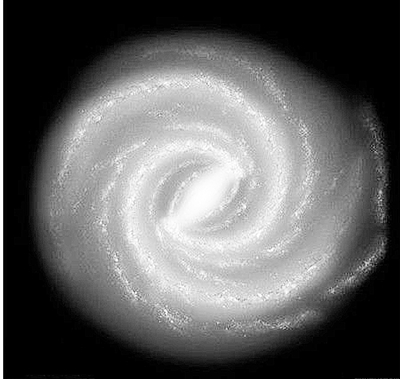
最大规模银河系星际尘埃3D图出炉(图)
银河系星 3D图
2015/7/15
太空尘埃其实很美丽,美国哈佛大学研究人员最新绘制的银河系尘埃3D图像显示,整个银河系星星点点地散落着星际尘埃。这是同类图像中规模最大的一幅,覆盖了四分之三的天空,从某种意义上来说,它也算得上是银河系的“自拍照”。借助尘埃的分布,科学家将能更好地勾画银河系的模样。
EXTRACTING 3D FREE-FORM SURFACE BOUNDARIES OF MAN-MADE OBJECTS FROM MULTIPLE CALIBRATED IMAGES: A ROBUST, ACCURATE AND HIGH RESOLVING POWER EDGEL MATCHING AND CHAINING APPROACH
Photogrammetry 3D Reconstruction
2015/5/18
This paper describes a purely geometrical approach for matching and chaining edgels, i.e. contours points with their tangent direction,
to reconstruct in a general way 3D rectilinear or curved surfac...
Testable Clock Distributions for 3D Integrated Circuits
3D Integration Prebond Testability Delay Lock Loops TSV Multiplexing
2014/12/8
The 3D integration of dies promises to address the problem of increased die size caused by the slowing of scaling. By partitioning a design among two or more dies and stacking them vertically, the ave...


